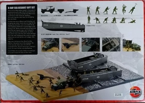
Airfix Models D-Day Sea Assault (1:72 Scale)
Revell Models 21cm Morser 18 or 17cm Kanone 18 and Sd.Kfz.9 Famo (1:72 Scale)
Revell Models Sd. Kfz.11, Pak 40 & AfrikaKorps (1:72 Scale)
Dragon Models Churchill Mk. III (1:72 Scale)
Tamiya Models German Machine Gun Troops Infantry (1:35 Scale)
Italeri Models Union Artillery American Civil War (1:72 Scale)
Italeri Models Union Infantry American Civil War (1:72 Scale)
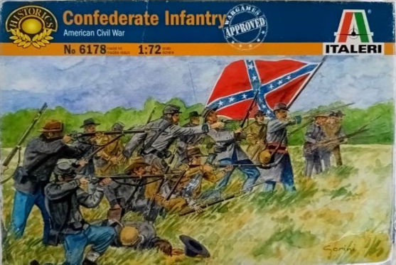
Italeri Models Confederate Infantry American Civil War (1:72 Scale)
Italeri Models French Artillery Set Napoleonic Wars (1:72 Scale)
Italeri Models French Artillery Napoleonic Wars (1:72 Scale)
Italeri Models French Line Infantry Napoleonic Wars (1:72 Scale)
Italeri Models Waterloo 1815 French Line Infantry (1:72 Scale)
Italeri Models Waterloo French Heavy Cavalry (1:72 Scale)
Italeri Models Waterloo French Infantry (1:72 Scale)
Italeri Models French Warriors- 100 Years War (1:72 Scale)
Pegasus Hobbies WWI French Infantry 1917/1918 (1:72 Scale)